

STATISTICS
WANTED
Lionfish
Stats from the Top Cats!
Statistics on Lionfish Sightings
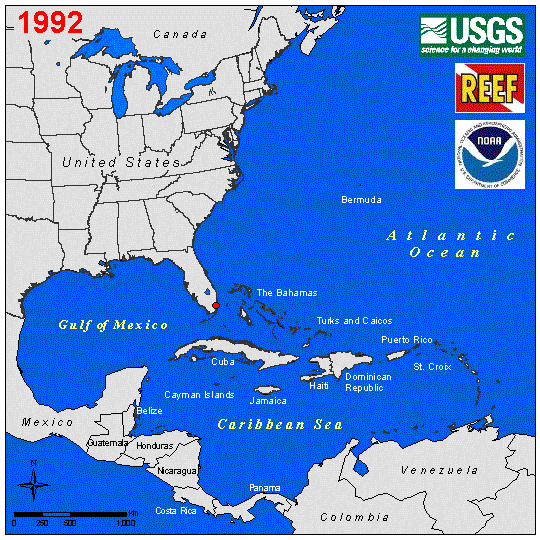
This map is a compilation of lionfish sighting reports in North America from 1992 through 2010 by the United States Geographical Survey (USGS). It provides geographical and historical information to show the distribution of lionfish over space and time.
This map was developed from a variety of Federal, State, municipal agencies, universities, public utilities, engineering and private consultant firms. The National Oceanic and Atmospheric Administration (NOAA) and the Reef Environmental Education Foundation (REEF) were major contributors of this map as well. This map is intended for geographic display and informational purposes only. The lionfish locations are represented by large red markers. (Any additional information on these sightings can be found on the USGS website.)
Website Designed by Tami Beckel for Vone Research, Inc. © 2010. Vone Research is a 501(c)3, non profit organization.
Please report broken links to the Webmaster